

Go back in time when quarries were a part of Brisbane’s development

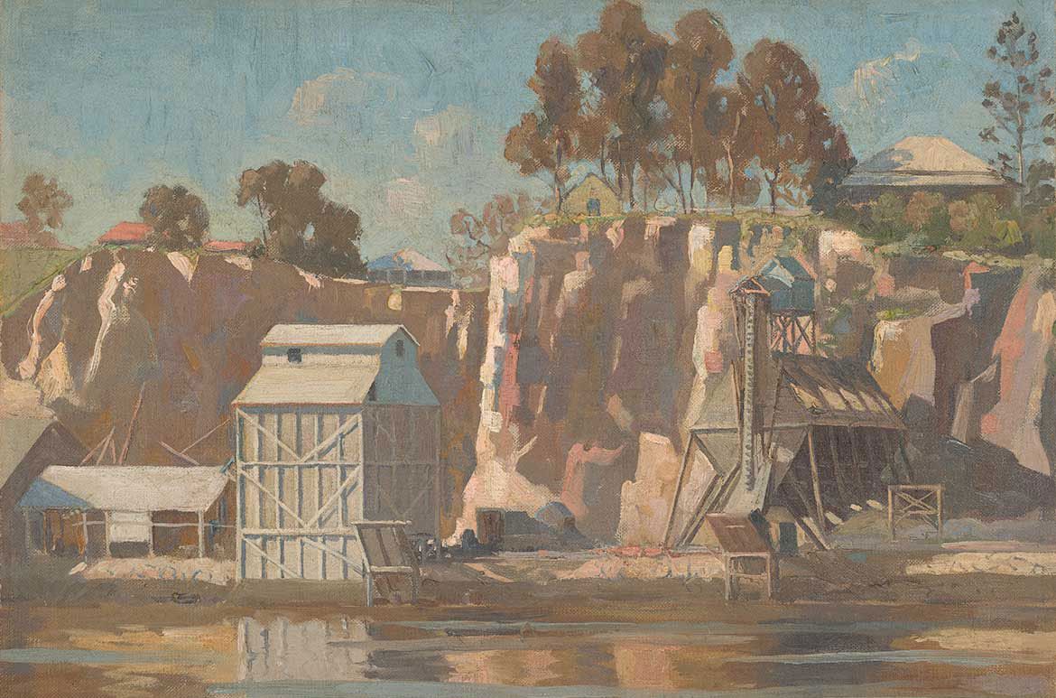
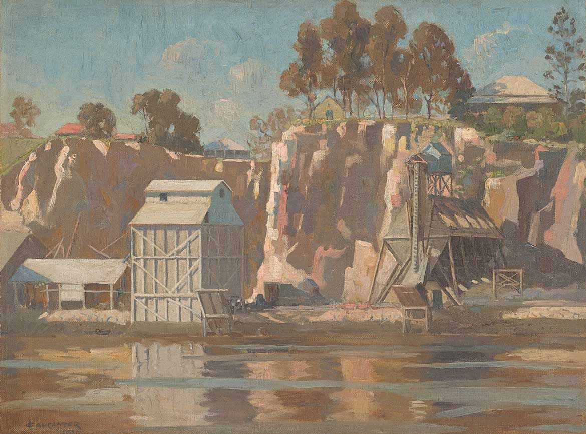
Charles H Lancaster, Australia 1886–1959 / The Quarry (Kangaroo Point) 1930s / Oil on canvas / 44.5 x 54cm / Gift of Kathleen Marshall through the Queensland Art Gallery | Gallery of Modern Art Foundation 2014 / Collection: Queensland Art Gallery | Gallery of Modern Art / © Estate of the artist / View full image
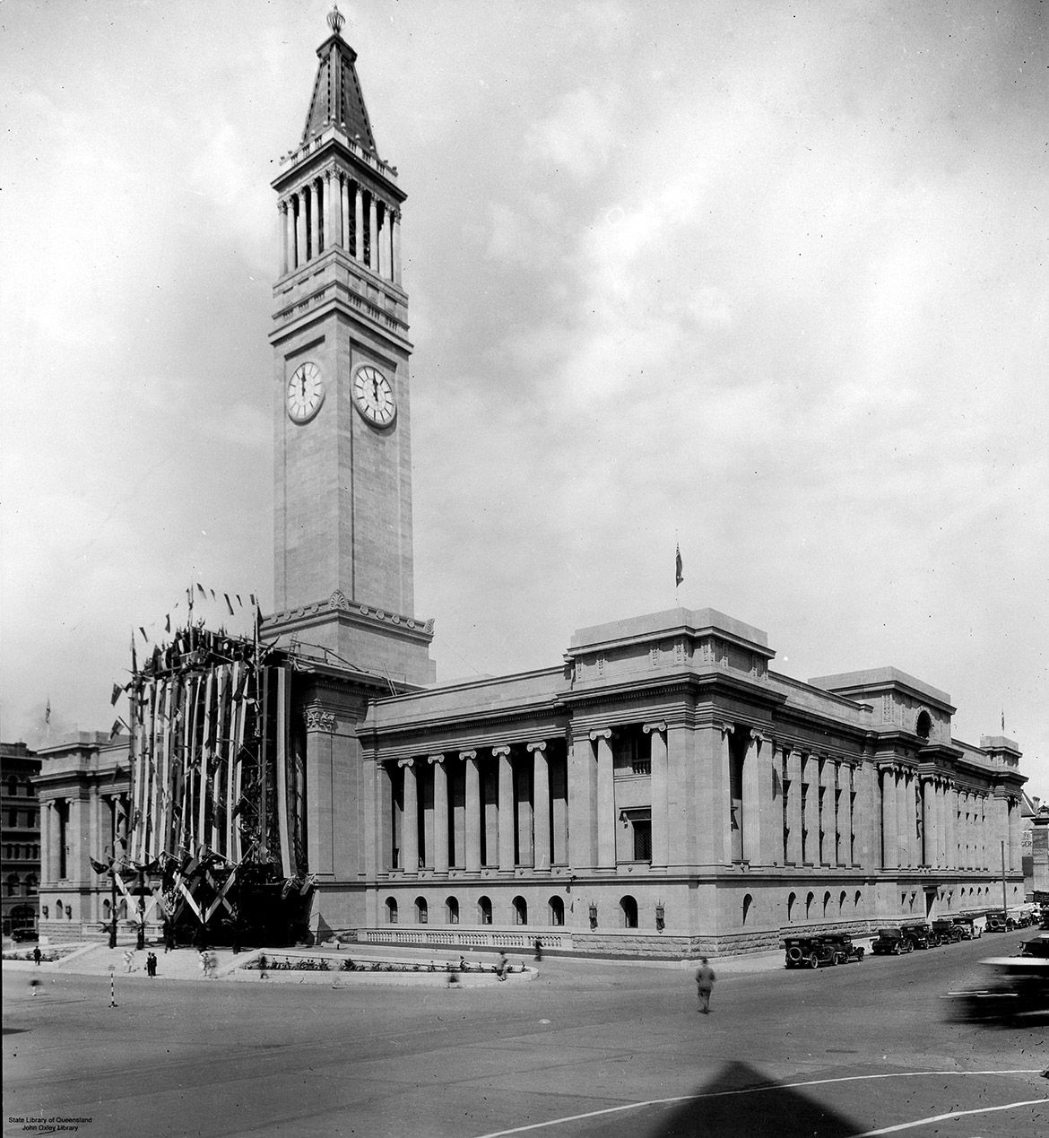
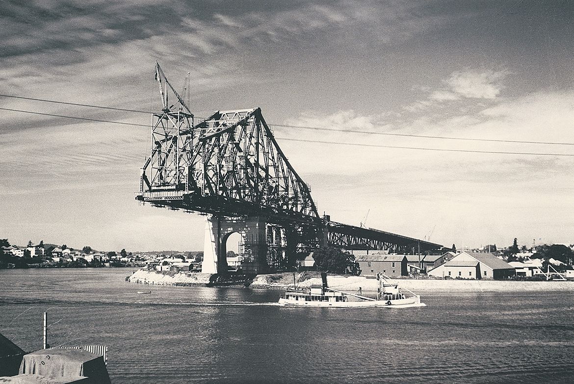
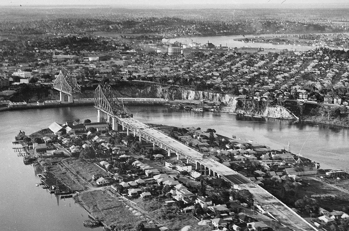
The subject of Charles H Lancaster’s work The Quarry c.1930 (illustrated) can be linked to the development of Brisbane — a time of nation-building projects across Australia to offset the effects of the Great Depression, typified in Brisbane by the construction of the Brisbane City Hall (1920–8 April 1930) (illustrated) and the Story Bridge (1935–6 July 1940) (illustrated), these ambitious public constructions ignited the enthusiasm of contemporary artists and inspired numerous images of industry and the dynamic city.
Let us take you on a journey through some of Brisbane’s landmarks and how ‘Brisbane Tuff’ was integral to the capital’s development from the nineteenth and early twentieth centuries.
Brisbane City Hall 1930

Official opening of City Hall, Brisbane 1930 / 31184 / Courtesy: John Oxley Library, State Library of Queensland, Brisbane / View full image
Geoffrey Powell Construction of Story Bridge 1939

Geoffrey Powell, Australia 1918 -89 / (Construction of Story Bridge, Brisbane) 1939, printed 2005 / Gelatin silver photograph on paper / 21.9 x 33cm (comp.) / Purchased 2005 / Collection: Queensland Art Gallery | Gallery of Modern Art / © Geoffrey Powell Estate / View full image
Construction of the Story Bridge c.1939

Story Bridge Construction Album 1931-1940 / Image number: 28452-0001-0273 / Image courtesy State Library of Queensland, Brisbane / View full image
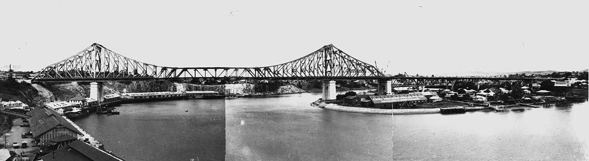
Story Bridge a year before completion 1939

Story Bridge 1939 / Negative number: 68325 / Image courtesy State Library of Queensland, Brisbane / View full image
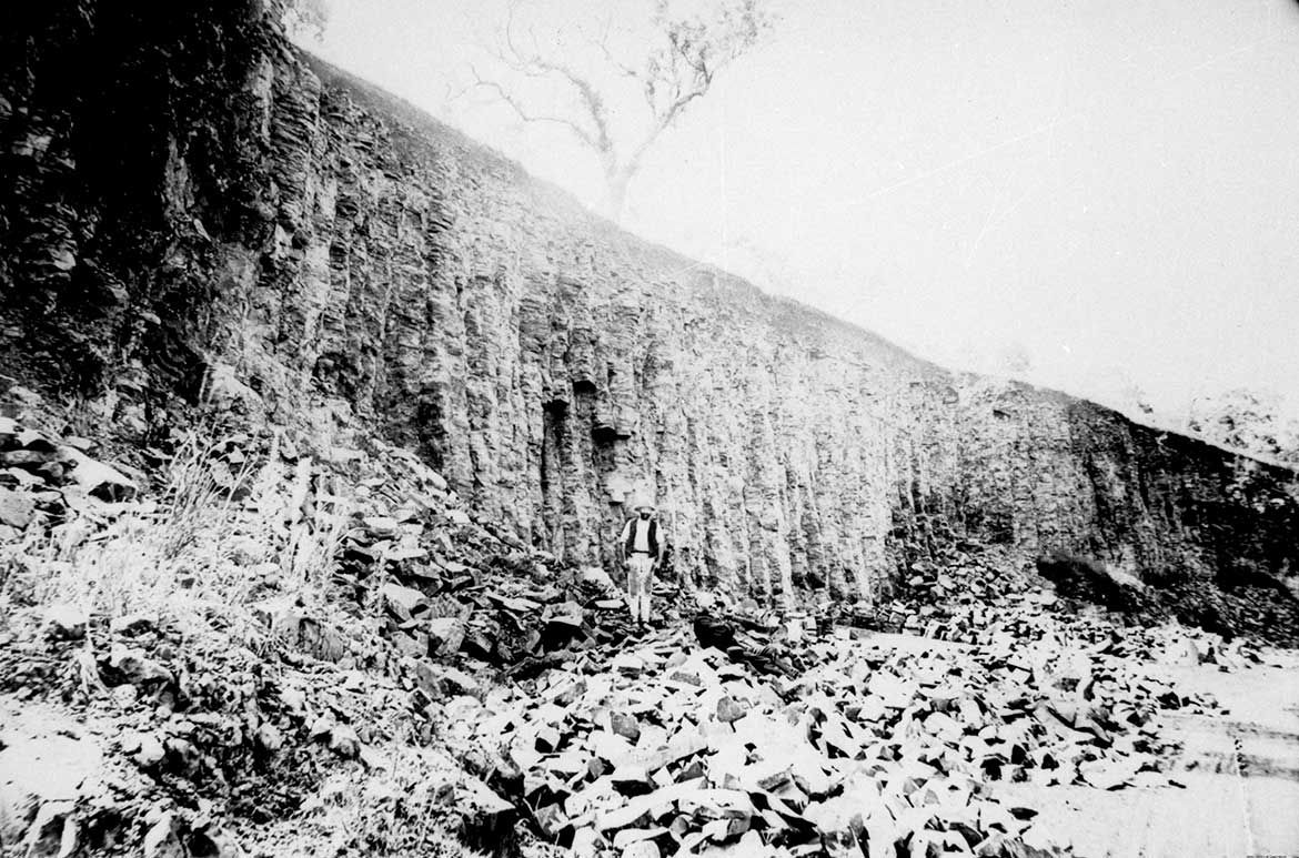
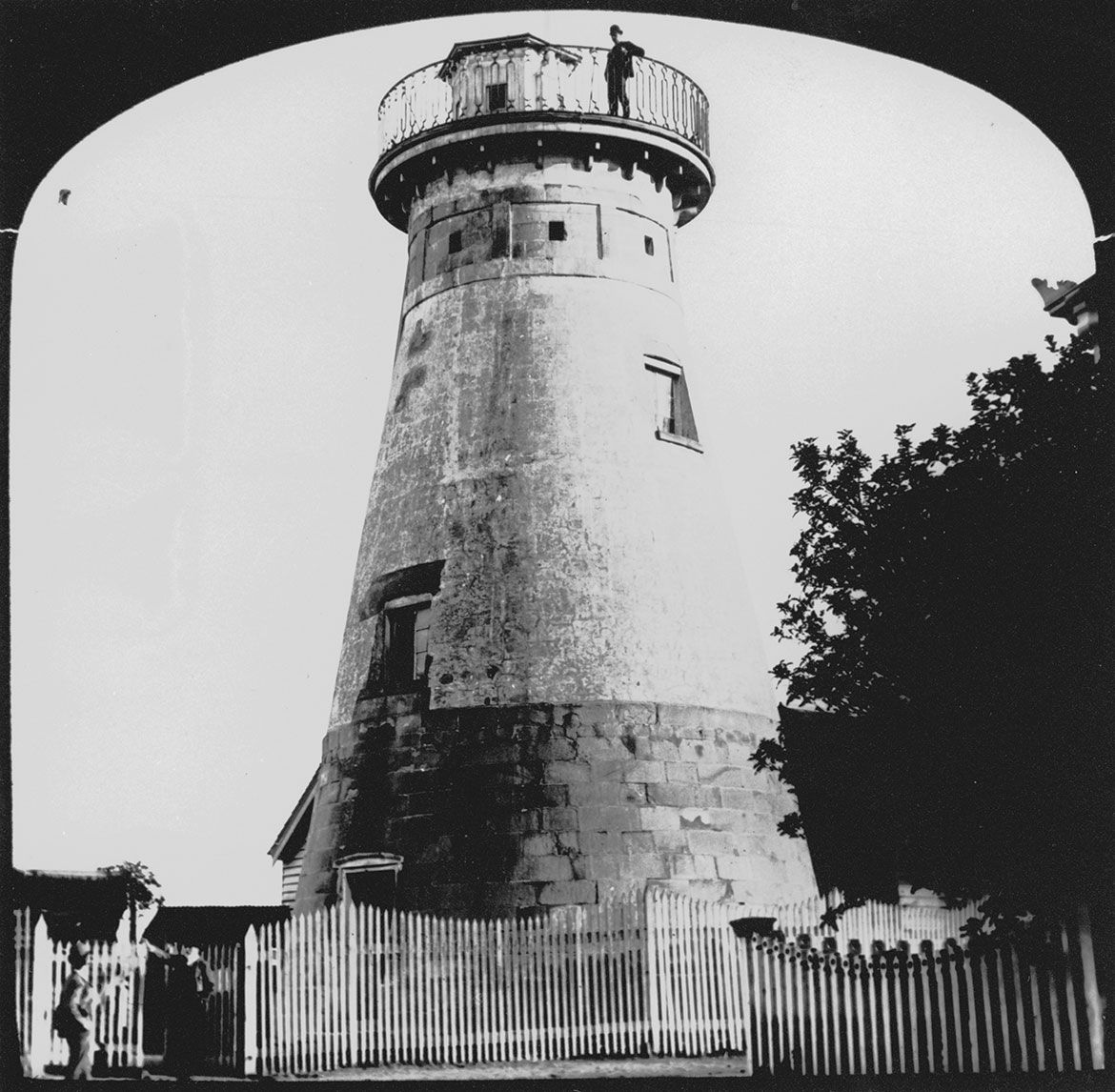
One quarry at Kangaroo Point, located on the Brisbane River opposite the City Botanic Gardens, has always been an important part of Brisbane, the ‘Brisbane Tuff’ cliffs (illustrated) being a major source of distinctive — pink, green, blue-grey, and purple — building stone quarried for Brisbane’s early public buildings, most notably the The Windmill (The Observatory) at Wickham Terrace (1824–28) (illustrated), the oldest convict-built structure surviving in Brisbane built to grind grain for the settlement; the Commissariat Store at William Street (1828–29) (illustrated), another surviving convict-built building; Brisbane General Post Office, Queen Street (1871–72) (illustrated) an Italianate influenced design; St Mary’s Anglican Church, Kangaroo Point (1872–73) (illustrated); and Cathedral of St Stephen constructed in several stages (1860, 1870–74, 1884, and 1920–22) (illustrated).
Kangaroo Point Cliffs Quarry

The base of Kangaroo Point cliffs, Brisbane / Negative number: 182248 / Photograph courtesy: John Oxley Library, State Library of Queensland, Brisbane / View full image
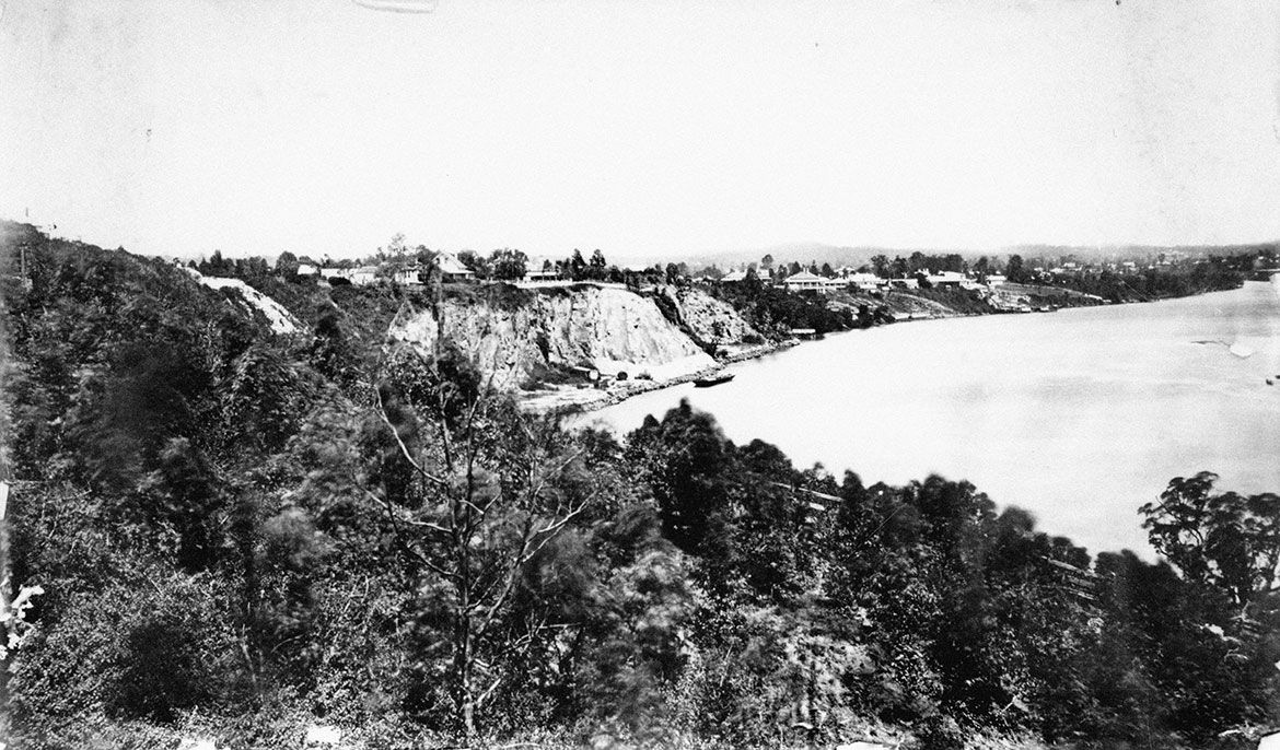
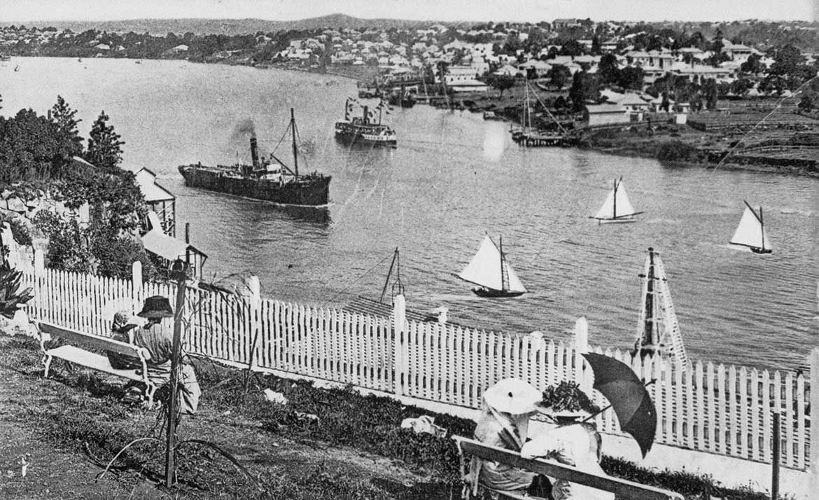
Kangaroo Point Cliffs showing St Mary’s Anglican Church c.1913

The Kangaroo Point Cliffs, across the Brisbane River from the Botanical Gardens, c.1913 / 94520 / Courtesy: State Library of Queensland, Brisbane / View full image
Kangaroo Point Cliffs c.1920

View of the Kangaroo Point cliffs c.1920 / V1-FL1452675 / Courtesy: State Library of Queensland, Brisbane / View full image
The Windmill (Observatory) c.1892

The Observatory c.1892 / 145377 / Image courtesy: John Oxley Library, State Library of Queensland, Brisbane / View full image
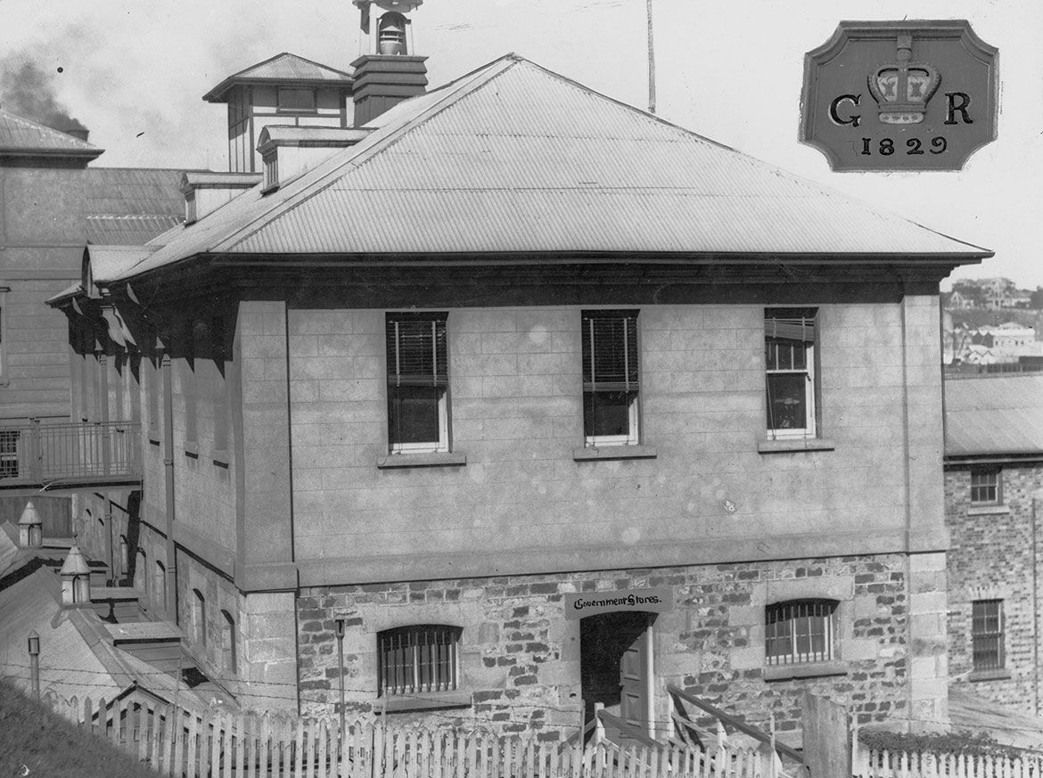
Commissariat Stores 1928

Commissariat Stores 1928 / Negative number: 103466 / Image courtesy: State Library of Queensland, Brisbane / View full image
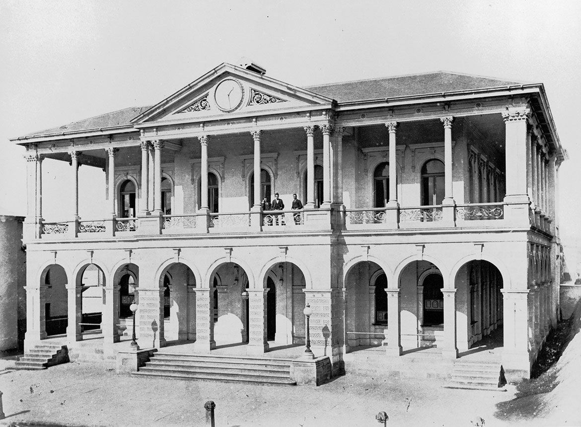
General Post Office c.1875

General Post Office c.1875 / Negative number: 143672 / Image courtesy: State Library of Queensland, Brisbane / View full image
St. Mary’s Church of England 1958

St. Mary’s Church of England above the Kangaroo Point Cliffs 1958 / Image number: 6523-0001-0021 / Image courtesy: State Library of Queensland, Brisbane / View full image
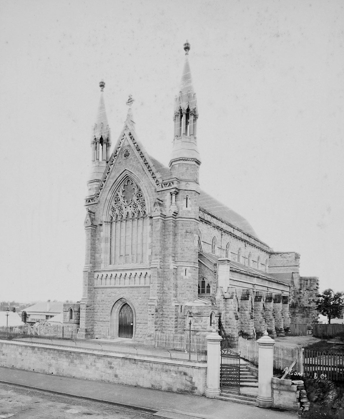
St. Stephen’s Cathedral c.1879

St. Stephen’s Cathedral in Brisbane 1870, photographed c.1879 by A. Lomer & Co / APU-049-0001-0019 / Image courtesy: State Library of Queensland, Brisbane / View full image
After 150 years of quarrying, the Kangaroo Point Cliffs now comprise a distinctive vertical rock face 25 metres high — the exposed rock of ‘Brisbane Tuff’ — now a distinctive feature of the Brisbane city landscape. The cliffs were originally steep rocky slopes with boulder outcrops and vegetation, first identified during the exploration of the Brisbane River as early as 1823. From 1825 when the Moreton Bay Penal Settlement moved upstream to Brisbane’s earliest suburb at Kangaroo Point, the ground covered in grassland and bush was cleared and planted with crops to supply food for the new settlement, while a quarry was established at the base of the cliffs to supply stone for the development of the fledgling convict colony.
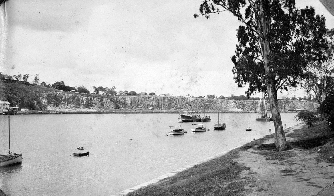
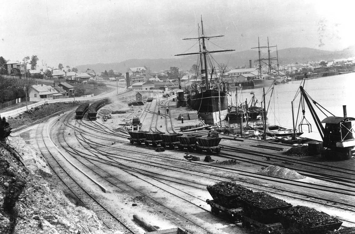
By the mid-1880s the quarry face extended a little over 100 metres (one-eighth the length of the present quarry face), however with the construction of coal wharves (illustrated) along the southern end of the cliffs at South Brisbane, it necessitated cutting back the remaining cliffs. This created the dramatic length of perpendicular drop that distinguishes the Kangaroo Point Cliffs today. By 1976 the rock had been exploited and the quarry closed.
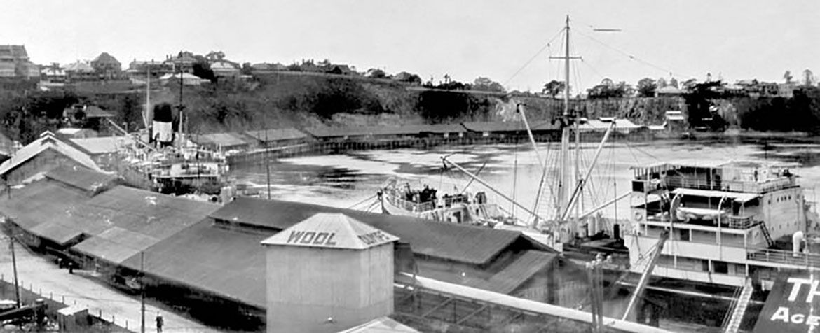
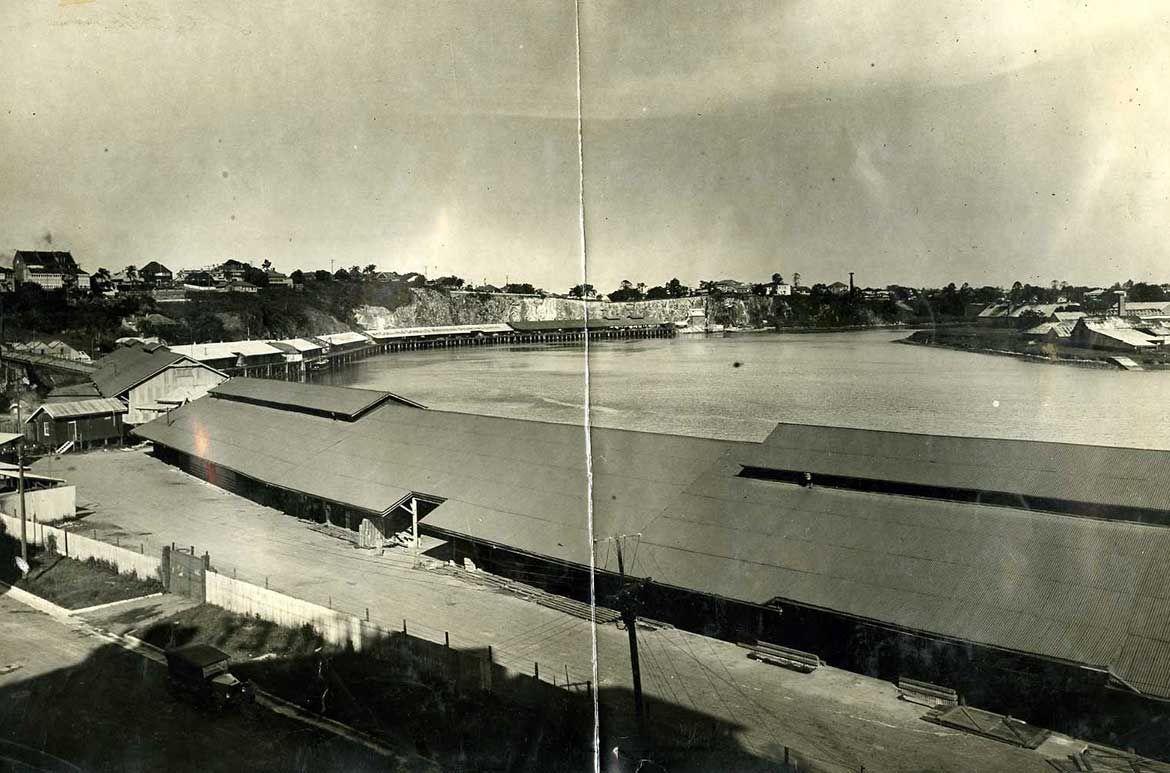
South Brisbane Coal wharves

The Quarries, Kangaroo Point looking toward the Coal Wharves at South Brisbane / Courtesy: Brisbane Images, Brisbane City Council. / View full image
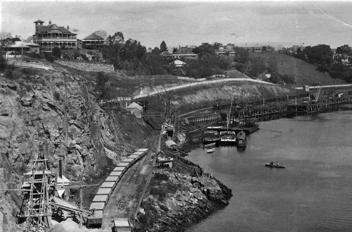

Coal Wharves at South Brisbane / Resource Identifier BCC-C120-13343 / Courtesy: Brisbane Images, Brisbane City Council. / View full image
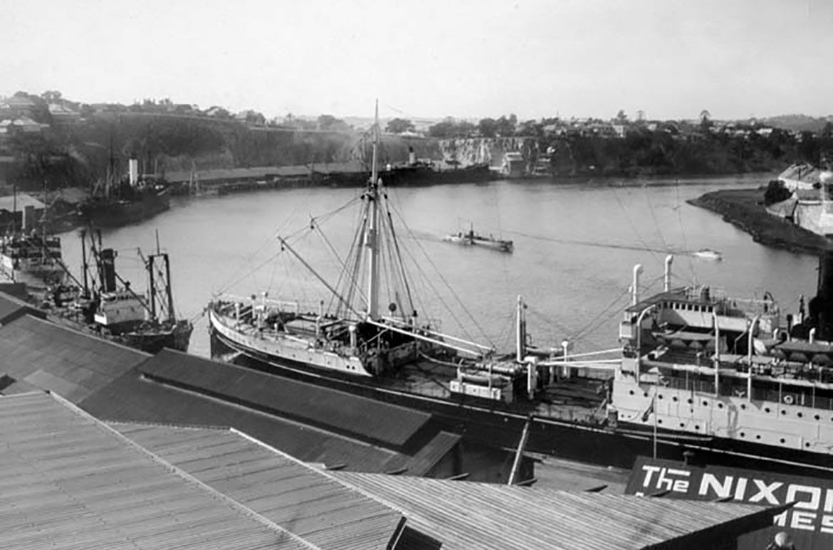

Dry Docks at South Brisbane looking back to Kangartoo Point Cliffs c.1890 / 240253 / Courtesy: State Library of Queensland, Brisbane / View full image
‘Brisbane Tuff’ is the most striking of the building stones quarried in Brisbane, even though its rough-dressed stone was used in the construction of Brisbane’s earliest buildings, it was not suited to polishing. Originally used for ballast for sailing ships, it was dedicated to constructing wharfs, marine walls along the river, and the crushed rock for road-making, kerbing, and pavement gravel. In the 1930s a manufactured stone called ‘Benedict stone’ — a mixture of cement and crushed ‘Brisbane Tuff’ — was also used for building as an alternative to full stone construction.
The quarry at Kangaroo Point was not the only source of ‘Brisbane Tuff’, the rock seam runs through Brisbane from the northern suburbs of Stafford, Windsor, Herston, Spring Hill, Fortitude Valley, Bowen Hills, Petrie Bight, across the river to Kangaroo Point then through Dutton Park to Six-mile Rocks — with a total of nine local quarries in all.
Petrie Bight Quarry c.1890

View from Petrie Bight, c.1890 / 178147 / Image courtesy: State Library of Queensland, Brisbane / View full image
Charles H Lancaster ‘The Quarry’ c.1930

Charles H Lancaster, Australia 1886–1959 / The Quarry (Kangaroo Point) 1930s / Oil on canvas / 44.5 x 54cm / Gift of Kathleen Marshall through the Queensland Art Gallery | Gallery of Modern Art Foundation 2014 / Collection: Queensland Art Gallery | Gallery of Modern Art / © Estate of the artist / View full image
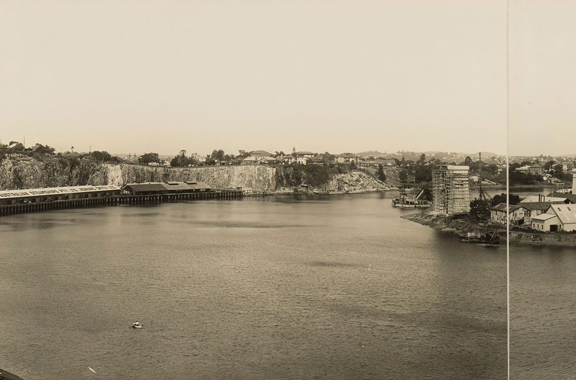
It is the area opposite Kangaroo Point — at Petrie Bight under Bowen Terrace — that Charles H Lancaster’s quarry structuresspecifically relate to — a section of exposed quarried cliff to the right of the Story Bridge travelling north (illustrated). The Howard Smith Wharves below the cliffs were expanded to provide relief work during the depression years in conjunction with the construction of the Story Bridge — beginning 24 May 1935 and opening to traffic on 6 July 1940. We can reference contemporary photographs of the buildings portrayed in The Quarry from at least 1912, however by 1936 only the stone crusher remains and it too disappears by 1938.
1910 (No quarry)

Petrie Bight looking over Kangaroo Point to the Merthyr reach of Brisbane c.1910 / 188671 / Courtesy: State Library of Queensland, Brisbane / View full image
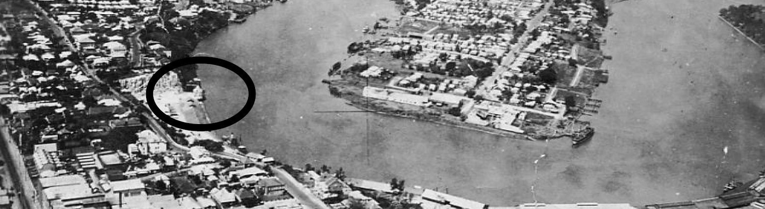
1912 (quarry bottom left)

Brisbane River from Bowen Terrace c.1912 with the quarry bottom left / Courtesy: State Library of Queensland, Brisbane / View full image
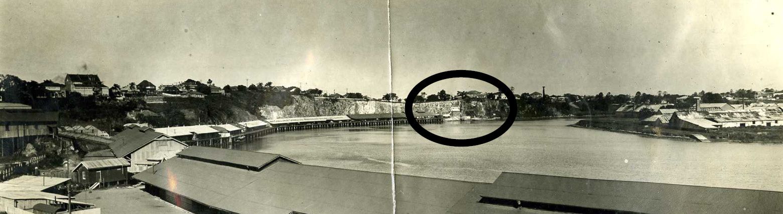
1926-27

Petrie Bight, October 1926 / 1007220 / Courtesy: Queensland State Archives / View full image

Petrie Bight, June 1927 / 1007233 / Courtesy: Queensland State Archives / View full image
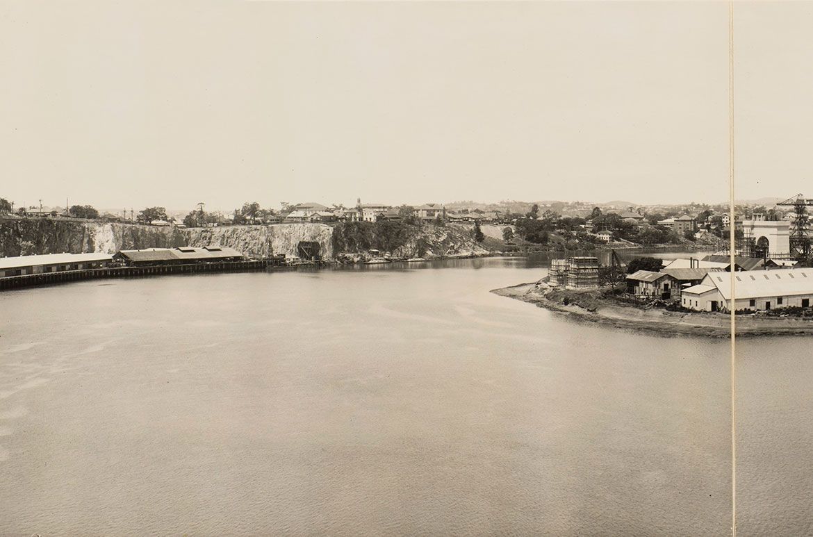
1931

Aerial View Fortitude Valley and Kangaroo Point 1931. Site of Proposed Story Bridge / Courtesy: Brisbane Images, Brisbane City Council. / View full image
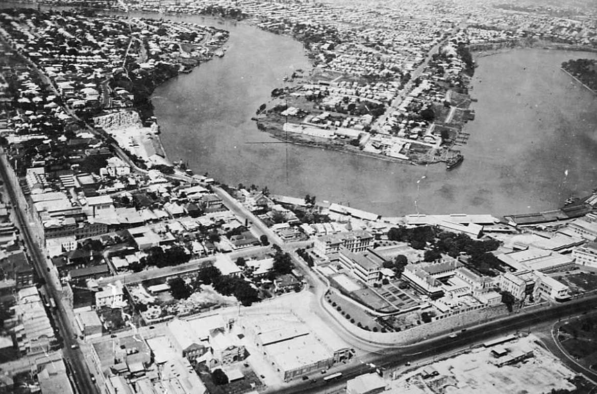

Aerial View Fortitude Valley and Kangaroo Point 1931. Site of Proposed Story Bridge / Courtesy: Brisbane Images, Brisbane City Council. / View full image
1934

Story Bridge Site Between Kangaroo Point and Fortitude Valley 1934 / Resource Identifier BCC-D-20150011 / Courtesy: Brisbane Images, Brisbane City Council / View full image

Story Bridge Site Between Kangaroo Point and Fortitude Valley 1934 / BCC-D-20150011 / Courtesy: Brisbane Images, Brisbane City Council / View full image
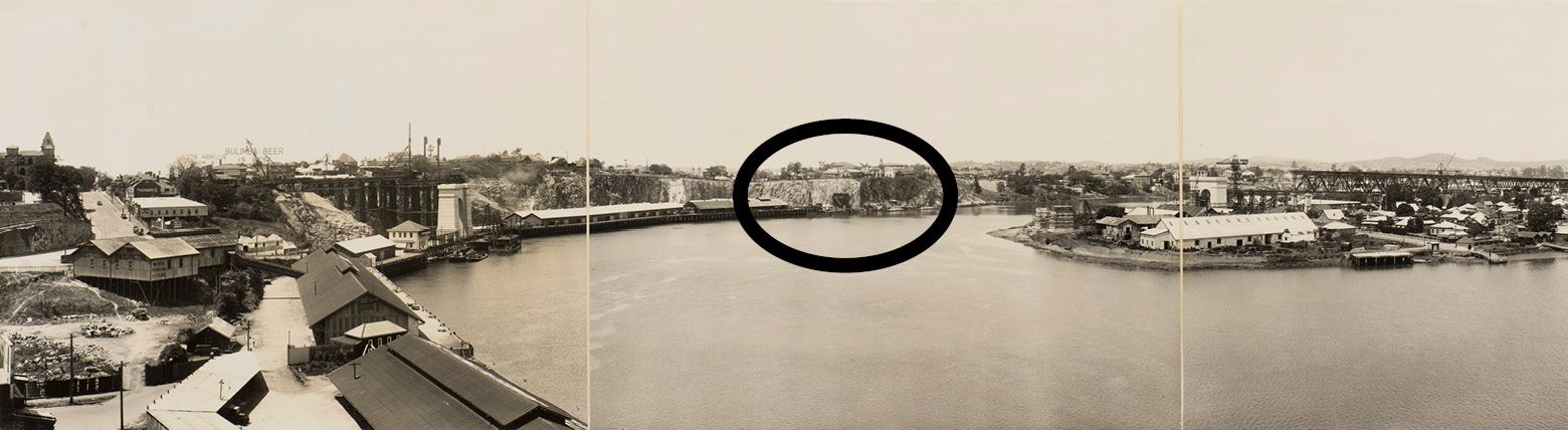
1937

Panorama showing the beginning of the construction of the Story Bridge, 1937 / 6377-0003-0054 / Image courtesy State Library of Queensland, Brisbane / View full image

Panorama showing the beginning of the construction of the Story Bridge, 1937 / 6377-0003-0054 / Image courtesy State Library of Queensland, Brisbane / View full image
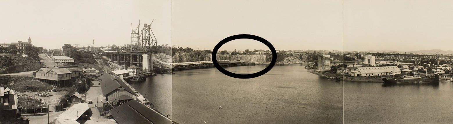
1938

Panorama showing the main northern pier being constructed 1938 / Image number: 6377-0003-0084 / Courtesy State Library of Queensland, Brisbane / View full image

Panorama showing the main northern pier being constructed 1938 / Image number: 6377-0003-0084 / Image courtesy State Library of Queensland, Brisbane / View full image
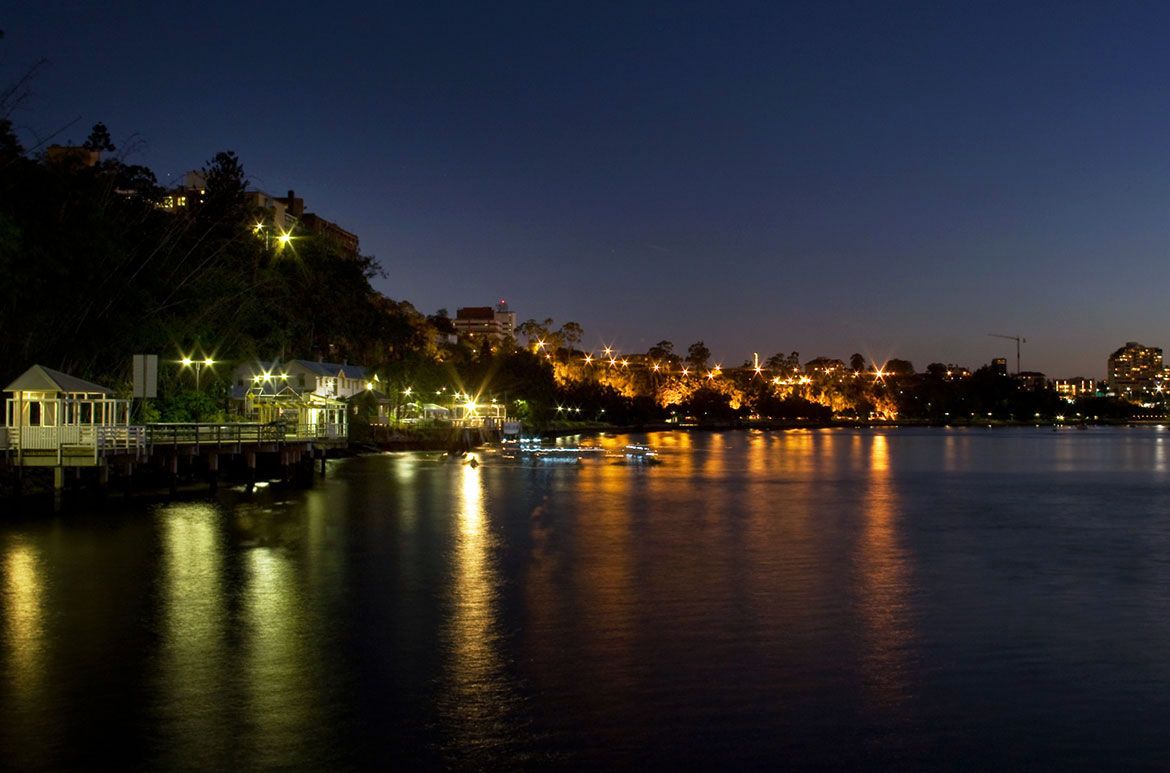
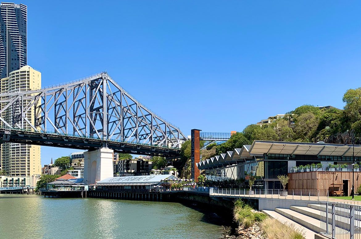
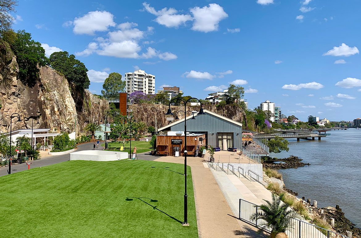
The Kangaroo Point Cliffs, now heritage-listed, is home to Brisbane’s outdoor rock climbing community and is dramatically lit at night, together with the Howard Smith Wharves which also celebrates its waterfront history, have both been revitalised into entertainment precincts — far removed from their origins in the development of Brisbane — breathing new life into those locations for both locals and visitors.
Kangaroo Point Cliffs today

Kangaroo Point Cliffs / Photograph: Sheba / Courtesy: Wikimedia Commons / View full image
Howard Smith Wharves today

Howard Smith Wharves / Photograph: Kgbo / Courtesy: Wikimedia Commons / View full image

Howard Smith Wharves / Photograph: Kgbo / Courtesy: Wikimedia Commons / View full image
Curatorial extracts, research and supplementary material compiled by Elliott Murray, Senior Digital Marketing Officer, QAGOMA